


When OpenStreetMap becomes SimCity
Google Maps, OpenStreetMap or other mapping software become games and make the fortune of developers.
The possibilities offered by the API of these services are currently (in 2014) poorly exploited. Although it has become common to place a map on a website to locate a store in the city or the country, this is a rather simplistic use, next opportunities that can be glimpsed in the fact of having a world map.
The final version of the game Simcity became so realistic that one can not distinguish a virtual creation of a real map as presented by Street View. Especially when Street View buildings were designed with Building Maker!
A developer for the site Gamasutra tells us how reproducing in Sim City a part of a map taken from Google Earth and representing his city, he was able to observe the actual traffic, anticipate bottlenecks and find their causes.
The first lesson that can be drawn from this experience is that planners should have fun more often with Sim City to find the optimal designs to create a new city.
But it should not be limited to this, as Sim City is a game and its scientific value is not checked, and this is where developers could consider creating instruments that would provide services of that kind, but more real. It's kind of the point of CUSP, the Centre for Urban Science in New York which collects data to be used to improve the city through new technologies.
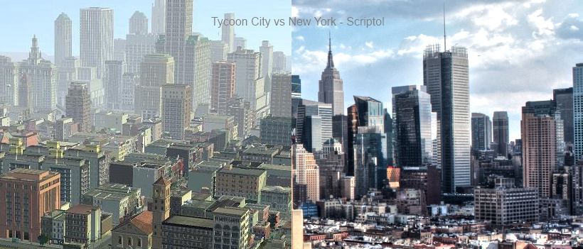
On the left the game Tycoon City: New York, on the right a picture of New York
It is possible to interface mapping services with all kinds of software. MapMaker allows everyone to complete the map of his region, TillMill change the appearance of the maps displayed. It is therefore possible to create new services that interact with Google Maps or OpenStreetMap more freely through their APIs.
To return to the example, if we add a traffic simulation directly on the map that can provides forecasts and all the benefits. Eg improving sales distribution would not rely only on the optimization through operational research but would reflect current events and all aspects of the map.
If we wanted to interface a city simulator with a mapping service we will use instead Simutrans than Sim City, because it is open source software.
Business simulation game Tycoon City: New York offers to build the city and create businesses to grow. If you had a life size version of the city - and in fact we have it with OpenStreetMap - this would allow to create businesses as easily as in the game providing was added to map all statistical information that provides this kind of game
It is an approach that can be followed to create a new service, which is the addition of new data for mapping services. These data will allow to do business with greater certainty, and this would yield gold.

OpenStreetMap (top) vs Google Map (bottom): a more detailed map...
Tools and links of interest
- iD.
Written in JavaScript with the D3 library it is probably the best map editor for OpenStreetMap. It is not very different from SimCity! But what we add enriches the World map. - 3D City.
Online version of the SimCity game made in HTML 5 and WebGL. - Blockland.
Paid game, a kind of SimCity in 3D: the world is assembled with block as a virtual lego.
3D City